Maps of Russia Through the Ages
Russia has had many names and has grown over the course of centuries. From the 10th-17th centuries, the country was ruled by a class of nobles called boyars with a tsar (zahr) as the figurehead ruler. In 1721, Peter I, also known as Peter the Great, was named Emperor of all Russia. From then on, the Russian empire had a Tsar or Tsarina (zahr-ee-nah) who ruled as an absolute monarch. By the end of the 1800s, the Russian Empire was huge, covering almost 1/6 of all the land on earth. The Russian Empire ended in 1917 with the abdication and subsequent murder of Tsar Nicholas II following the Russian Revolution.

Russian Empire map from britannica.com

Russian Empire map from wikipedia.org
Following the Revolution of 1917 and a period of transitional government, in 1922 the Union of Soviet Socialist Republics or U.S.S.R. became the official name and government of Russia. This was a union of fifteen national republics with a highly centralized Communist government based in Moscow. The leader of the country was the General Secretary of the Communist Party. The U.S.S.R. was the largest country by area in the world with 8,649,500 square miles of land and covered eleven time zones. The U.S.S.R. fell apart in 1991 and became the Russian Federation. Many republics, such as Estonia, Latvia, Ukraine, and others, became independent nations following the collapse of the U.S.S.R.

Map of the U.S.S.R. in 1989 from wikipedia.org
The current country is known as the Russian Federation which is made up of the main section of Russia after the collapse of the Soviet Union. It is still the largest country in the world by area and the ninth most populous country with over 142,000,000 residents. The capital is Moscow. Russia has coasts on three oceans, Atlantic, Pacific, and Arctic. Russia has 100,000 rivers and some of the largest lakes in the world, including Lake Baikal which has more water than any other lake on Earth.
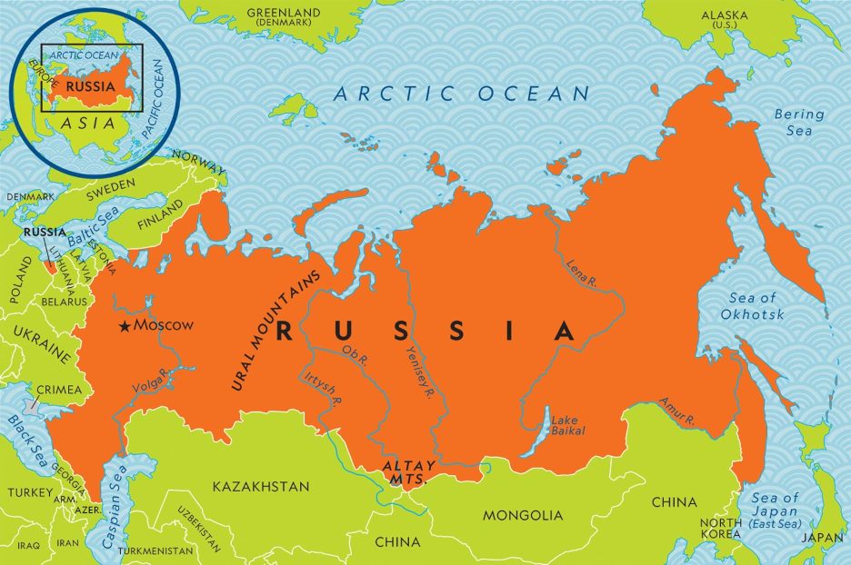
Map of Russia from kids.nationalgeographic.com